
Viz World Classic User Guide
Version 23.0 | Published December 12, 2023 ©
Ruler Tool

-
Map layers: Allows you to measure distances on maps, and displays other useful information.
-
Image and movie layers: Allows you to measure distances on images and movies.
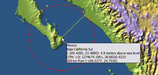
To Measure a Distance
Drag from the start point to the end point of the distance to be measured. The display shows the location and height above sea level of the end point, and the distance between points:
To Specify the Distance Units
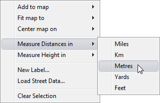
Right-click the map, point to Measure Distances in or Measure Height in on the context menu, then click the appropriate unit on the submenu.