
Viz World Classic User Guide
Version 23.0 | Published December 12, 2023 ©
Browse Street/Shape Data Tool

Map layers: Allows you to display the names of features in imported data by pointing at them, and optionally label them or add them to the Details list.
As you move this over the map the tool tip shows you the name of each imported data feature.
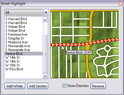
Left-clicking the map layer displays the Street Highlight tool for adding streets in the area you clicked. You can add whole streets, sections of streets and show direction.
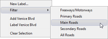
Right-clicking the map layer displays a context menu that allows you to filter the data, add a new label to the map, add the feature to the Details list, or label the feature:
If you are labeling a street the label is drawn aligned with the direction of the street. You can use the Text tool to move or rotate the label as desired.
To Add a Section of a Street
-
Click the Browse Street/Shape Data button.
-
Left-click the map layer to display the Street Highlight tool.
-
Select the street and click the Add section button.
-
Left-click the street on the map to set start and end points for your section. The street section is added to the Details list.
-
Close the Street Highlight tool.