
Viz World Classic User Guide
Version 23.0 | Published December 12, 2023 ©
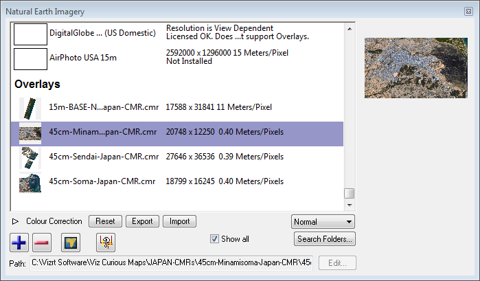
Adding Satellite Imagery
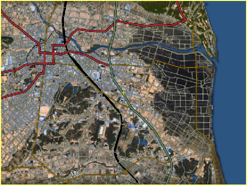
You can add geo-referenced satellite imagery to your base map. Other features like street data appear on top of it.
To Add Satellite Imagery to the Base Map
-
From the View menu select Options.....
-
Select Locations and click Installed Imagery....
-
Click the + button and open the CMR files.
-
Click the Fit images to selected map button and close the window.
-
From the Styles menu select Styles Editor....
-
Select the Topography tab.
-
Select your style sheet and set it to Natural Earth. All satellite images appear as part of your map; however, they only appear if you use style sheets based on Natural Earth.
-
Optional: From the Contents tab select the Streets tab and load the street data for your region to see how streets are overlaid.
See Also